Sandakphu Trek
Trek Basics
The Sandakphu Trek is one of the most iconic treks in the Eastern Himalayas, often referred to as the “Paradise of Trekkers.” It takes adventurers on a scenic journey through diverse landscapes, quaint mountain villages, and dense forests. Sandakphu, at an altitude of 11,930 feet (3,636 meters), is the highest point in West Bengal and offers an unrivaled panoramic view of the world’s tallest peaks, including Mount Everest, Kanchenjunga, Lhotse, and Makalu. The trek is renowned for the stunning view of the “Sleeping Buddha” formation, created by the peaks of the Kanchenjunga range.
This trek covers multiple captivating destinations, starting from Sepi, moving through scenic villages like Rummam and Gorkey, and reaching the mesmerizing high-altitude grasslands of Phalut and Sabarkum. The journey culminates at the main highlight, Sandakphu, known for its breathtaking sunrise views over the towering peaks. After exploring Sandakphu, the trek descends through the charming village of Gurdum.
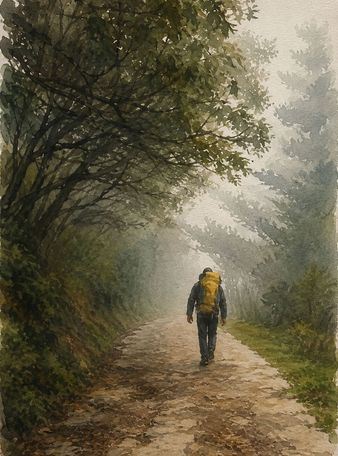
The Sandakphu Trek offers a blend of adventure and cultural immersion, as trekkers pass through traditional villages and interact with locals. It’s also a nature lover’s paradise, with trails lined with rhododendrons, magnolias, and vast stretches of bamboo forests. In spring, the landscape is adorned with blooming flowers, while autumn and winter bring clear skies and snow-covered trails.
The trek is famous for not just its majestic views, but also for the rich biodiversity of the Singalila National Park, home to the Red Panda, numerous species of birds, and Himalayan wildlife. From its awe-inspiring vistas to the serene forest trails and the warmth of village hospitality, the Sandakphu Trek truly lives up to its reputation as a must-do for all trekking enthusiasts.
Trek Highlights
The Sandakphu Trek offers a collection of unforgettable experiences, making it one of the most sought-after treks in the Eastern Himalayas. Here are the key highlights that set this trek apart:
Panoramic Views of Four of the World’s Highest Peaks
One of the most captivating features of the Sandakphu Trek is the breathtaking panoramic view of four of the world’s tallest peaks—Mount Everest (8,848 m), Kanchenjunga (8,586 m), Lhotse (8,516 m), and Makalu (8,481 m). The sight of these towering giants aligned on the horizon creates an awe-inspiring spectacle, drawing trekkers from around the world.
The Sleeping Buddha Formation
The Kanchenjunga range forms a distinct pattern that resembles a reclining Buddha, popularly known as the “Sleeping Buddha”. Sandakphu is the perfect vantage point to witness this unique formation, with the Kanchenjunga massif representing the face and upper body, while the surrounding peaks outline the rest of the form.
Exploration of Diverse Flora and Fauna
The trek passes through the Singalila National Park, which is home to a wide variety of flora and fauna. Trekkers can marvel at rhododendron and magnolia blooms in the spring, vibrant primulas dotting the trails, and enchanting bamboo forests. Wildlife enthusiasts may spot the elusive Red Panda, Himalayan black bear, barking deer, and a plethora of bird species, making it a paradise for nature lovers and photographers alike.
Cultural Immersion in Mountain Villages
The trek provides an opportunity to experience the local culture and lifestyle of mountain villages like Rummam, Gorkey, and Gurdum. Trekkers can interact with the local Sherpas, Lepchas, and other Himalayan communities, gaining insights into their traditional customs, farming practices, and unique hospitality. Staying in quaint village homestays adds an authentic cultural flavor to the adventure.
Phalut and Sabarkum: Unexplored High-Altitude Meadows
Beyond Sandakphu, the journey to Phalut and Sabarkum offers a distinct sense of solitude and adventure. These high-altitude meadows provide spectacular 360-degree views of the entire Himalayan range, stretching from Annapurna in Nepal to Chomolhari in Bhutan. Phalut, in particular, is a highlight for trekkers seeking a less-crowded, off-the-beaten-path experience.
Spectacular Sunrises and Sunsets
Sandakphu and Phalut are renowned for their breathtaking sunrise and sunset views. As the first rays of the sun hit the snow-clad peaks, the mountains light up in shades of gold, creating a surreal experience. Watching the sky transition during sunset is equally mesmerizing, with hues of orange, pink, and purple painting the landscape.
Sandakphu Trek Itinerary
The Sandakphu trek is a thrilling journey in the Eastern Himalayas, offering mesmerizing views of the snow-clad peaks of the world’s highest mountains. The trail winds through dense forests, quaint villages, and blooming rhododendron forests, culminating at Sandakphu, the highest point in West Bengal.
Day 1: Arrival at Sepi
- Travel Route: NJP / Bagdogra to Sepi
- Distance: 130 km
- Duration: Approximately 7 hours
- Overnight Stay: Sepi
Your adventure begins with a scenic drive from NJP or Bagdogra to the quaint village of Sepi. The route offers a glimpse of the lush tea gardens, winding mountain roads, and serene hamlets that characterize the lower Himalayas. Once you reach Sepi, you can spend the evening acclimatizing, exploring the surroundings, and preparing for the trek.
(Note: Ensure a morning arrival to NJP / Bagdogra. If you arrive late, you may need an extra night stay at Siliguri)
Day 2: Sepi to Gorkhey (Trek Begins)
- Trek Distance: 12 km
- Trek Type: Moderate ascent
The trek officially starts today. The route to Gorkhey passes through serene forests and remote villages, offering occasional views of the surrounding hills. The scenic trail is perfect for nature lovers, with bubbling streams, chirping birds, and lush greenery. As you reach Gorkhey, you’ll be enchanted by its beauty – a picturesque village by the riverside surrounded by hills.
Day 3: Gorkhey to Phalut
- Trek Distance: 15 km
- Trek Type: Steep ascent, challenging
The journey from Gorkhey to Phalut is considered one of the more demanding days of the trek due to its steep ascents. You’ll pass through thick rhododendron and bamboo forests, followed by an open stretch offering mesmerizing views of the Singalila range. Phalut is known for its panoramic views of the Kanchenjunga range and other Himalayan peaks. At Phalut, the vast open spaces and spectacular vistas make all the effort worthwhile.
Day 4: Phalut to Sabarkum
- Trek Distance: 7 km
- Trek Type: Gentle, easy-paced
After a strenuous climb the previous day, today’s trek to Sabarkum is a relatively easy one. The trail mostly descends, passing through beautiful meadows and sections of forested paths. The relaxed pace offers an opportunity to enjoy the tranquillity of nature and catch glimpses of local wildlife. Sabarkum is a small settlement, and spending the night here gives you a taste of the remote mountain life.
Day 5: Sabarkum to Sandakphu
- Trek Distance: 13 km
- Trek Type: Moderate
Today’s trail gradually ascends to Sandakphu, the highest point in West Bengal at 3,636 meters (11,929 ft). Sandakphu is famous for its panoramic views of the world’s four highest peaks – Everest, Kanchenjunga, Lhotse, and Makalu. Upon reaching Sandakphu, you will be rewarded with a breathtaking sunset view over the Sleeping Buddha, as the golden rays illuminate the mountain peaks.
Day 6: Sandakphu to Gurdum
- Trek Distance: 10 km
- Trek Type: Steep descent
The descent from Sandakphu to Gurdum takes you through dense forests filled with oak, bamboo, and rhododendrons. It’s a day to immerse yourself in the natural beauty of the region, with the forests occasionally opening up to offer expansive views of the surrounding mountains and valleys. Gurdum is a quiet village, and spending a night here allows you to experience local hospitality and mountain life.
Day 7: Gurdum to Srikhola – Drive Back to NJP
- Trek Distance: 2 hours to Srikhola
- Travel Route: Srikhola to NJP
- Duration: Approximately 7 hours drive
On the final day, it’s a short trek to Srikhola, passing through serene forests and streams. Once you reach Srikhola, the trek comes to an end, and you’ll board a vehicle for the return journey to NJP or Bagdogra. The scenic drive back marks the end of a memorable adventure.
Note: This itinerary is designed for trekkers with a moderate level of fitness. It is advisable to spend some time acclimatizing in Sepi and Sandakphu due to the altitude gain. Always carry appropriate gear and essentials, as the trek involves remote and rugged terrain.
Difficulty Level and Fitness Requirements
The Sandakphu Trek is a moderate to difficult trek, with certain sections requiring physical endurance and mental preparation. Trekkers should be aware of the terrain and the altitude gains and losses that define this trek.
- Day 2: Srikhola to Rammam
The trek involves a 2 km steep ascent where you gain around 1,300 feet in elevation. This section requires strong leg strength and stamina, as it involves continuous climbing. - Day 3: Gorkhey to Phalut
This is considered the most challenging part of the trek. The entire day involves climbing to Phalut, which is about 4,000 feet of ascent. It requires a good level of fitness and the ability to maintain a steady pace over a long and demanding climb. It’s crucial to acclimatize properly and stay hydrated during this segment. - Day 4: Phalut to Sabarkum
This section does not present major challenges in terms of elevation changes. However, the trail may still be demanding due to the distance covered and the changing weather conditions. - Day 5: Sabarkum to Sandakphu
There is no significant altitude change on this day, making it relatively easier compared to the previous days. However, maintaining energy levels is important for the descent that follows. - Day 6: Sandakphu to Gurdum
This section involves a 10 km descent with a drop of 4,000 feet. While descending might seem easy, it can be strenuous on the knees and legs, requiring balance and endurance. - Day 7: Gurdum to Srikhola
The final segment is a 4 km descent, with an initial drop of around 600 feet. Although short, the descent needs careful footwork, especially if the trail is wet or slippery.
Required Fitness Level
Trekkers need a moderate level of physical fitness for the Sandakphu Trek. Here are some fitness requirements and suggestions for preparation:
- Cardiovascular Endurance: Due to long trekking days and steep climbs, it is essential to have good cardiovascular fitness. Regular jogging, cycling, or brisk walking for at least 30–45 minutes a day for 4–6 weeks before the trek is recommended.
- Leg and Core Strength: Building leg strength is crucial, as you will be ascending and descending steep trails. Incorporate squats, lunges, and step-ups into your training routine.
- Flexibility and Balance: Stretching and flexibility exercises will help reduce muscle fatigue and improve your balance on uneven terrain.
- Acclimatization: Since the trek involves high altitudes, it’s vital to pace yourself, stay hydrated, and allow time for acclimatization, especially around Sandakphu and Phalut.
By preparing adequately and maintaining a steady pace, trekkers can successfully complete and enjoy the Sandakphu Trek’s challenges and rewards.
Best Time to Trek
The best time to visit Sandakphu for trekking is during the spring (March to May) and autumn (September to November) months. In spring, the trails come alive with vibrant blooms of rhododendrons, creating a stunning backdrop of colors against the lush greenery, making it an ideal time for nature lovers and photographers. The weather is mild, with clear skies and temperatures ranging from 10°C to 15°C during the day, perfect for trekking. In autumn, the skies are equally clear, offering breathtaking views of the towering Himalayan peaks, including Kanchenjunga, and the temperatures are pleasantly cool, ranging from 5°C to 12°C. Winter (December to February) offers a different allure with snow-covered trails and a serene landscape, but trekking during this time is challenging due to harsh weather conditions and sub-zero temperatures. For those seeking a balance of beauty and accessibility, spring and autumn are undoubtedly the best seasons to experience the majestic Sandakphu trek.