Sandakphu Trek
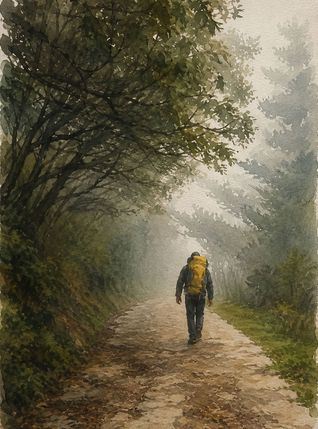
A Walking Journey Through the Singalila Ridge
The Sandakphu Trek is one of the best-known long-distance walks in the Eastern Himalayas, but its appeal goes well beyond reaching the highest point in West Bengal.
The trail follows the high ridges and forests of the Singalila region, moving between small mountain settlements, rhododendron and bamboo forests, open high-altitude slopes and remote Himalayan valleys. Along the way, the character of the landscape changes repeatedly: village paths give way to forest trails, forests open onto ridgelines, and the higher sections offer long views across Nepal, Sikkim, Bhutan and the mountains of the Eastern Himalayas.
At 3,636 metres (11,930 feet), Sandakphu is the highest point in West Bengal and lies on the Singalila Ridge along the India–Nepal border. From the summit, weather permitting, it is possible to see four of the world’s five highest mountains: Mount Everest, Kangchenjunga, Lhotse and Makalu.
Kangchenjunga dominates the view to the east. Its group of surrounding peaks creates the distinctive reclining profile commonly known as the Sleeping Buddha. To the west, the Everest group appears across the high ridges of Nepal.
But a Sandakphu walk should not be reduced to a succession of mountain viewpoints. The forests, villages, changing vegetation, birdlife and long stretches of quiet trail are equally important to the experience.
The extended Sandakphu–Phalut route is particularly rewarding for travellers who want to spend several days walking through the Eastern Himalayas rather than simply reaching Sandakphu by the shortest route.
Sandakphu Trek at a Glance
Highest Point | 3,636 m / 11,930 ft |
Region | Singalila Ridge, Darjeeling |
Protected Area | Singalila National Park |
Typical Trek Duration | 6–8 trekking days, depending on route |
Difficulty | Moderate to challenging |
Terrain | Forest trails, mountain paths, ridgelines and steep ascents and descents |
Highest Settlement | Sandakphu |
Major Extension | Phalut |
Best Seasons | Spring and autumn |
Nearest Airport | Bagdogra |
Nearest Major Railway Station | New Jalpaiguri (NJP) |
Main Trekking Gateway | Maneybhanjan |
The exact duration and daily distances depend on the route chosen. Sandakphu can be approached through the traditional Maneybhanjan route, while longer itineraries incorporate places such as Gorkhey, Phalut, Sabarkum, Rammam and Srikhola.
Why Walk the Sandakphu–Phalut Route?
The standard Sandakphu approach is already a rewarding mountain walk. Extending the journey towards Phalut, however, changes the character of the experience.
Instead of treating Sandakphu as the destination, the trail becomes a longer journey along the Singalila Ridge.
You spend more time in the forest, pass through small settlements, cross high open ridges and experience considerable changes in altitude and vegetation. The route also allows time to experience places such as Gorkhey, Samanden, Rammam and Srikhola, where the landscape is very different from the exposed high ridge around Sandakphu.
Phalut, at approximately 3,600 metres (11,811 feet), is the second-highest point of the Singalila Ridge after Sandakphu. It lies inside Singalila National Park and is particularly known for its close views of the Kangchenjunga range.
For an experienced walker, the Sandakphu–Phalut journey therefore offers something more substantial than a summit trek. It is a traverse through one of the most varied walking landscapes in the Darjeeling Himalayas.
The Landscape Along the Trail
One of the strengths of the Sandakphu trek is the variety of landscapes encountered within a relatively small geographical area.
Mountain Villages
The lower sections of the route pass through small settlements where agriculture, livestock and tourism form part of everyday life.
Places such as Gorkhey, Rammam and Srikhola retain a distinctly rural character. Homestays and simple mountain lodges provide opportunities to stay within these communities rather than passing through them as a visitor in a vehicle.
Rhododendron and Magnolia Forests
The Singalila landscape is particularly associated with rhododendrons, magnolias, oak, birch, bamboo and other Himalayan vegetation.
In spring, rhododendrons bring colour to sections of the forest, while the higher parts of the trail gradually become more open as the vegetation changes with altitude.
The timing of flowering varies with elevation and weather, so the landscape does not change everywhere at the same time.
High Ridge and Grassland
Above the forest belt, the character of the trail changes again.
The ridge becomes more open, and the walker begins to experience the scale of the surrounding mountains more directly. Around Sandakphu and Phalut, long sections of the trail follow exposed high ground with relatively few trees.
These are some of the most rewarding sections for mountain photography, particularly when the atmosphere is clear.
The Mountain Views from Sandakphu
Sandakphu’s greatest geographical attraction is its unusual position on the Singalila Ridge.
From the summit, the Himalayan panorama extends across several countries and includes four of the world’s five highest mountains.
Looking west, the Everest group can be seen across Nepal. Everest itself is relatively distant, and its appearance can vary considerably depending on atmospheric conditions.
Looking east, Kangchenjunga dominates the skyline. The massif and its neighbouring peaks create the formation commonly referred to as the Sleeping Buddha.
The view can also include Lhotse and Makalu, creating an unusual Himalayan panorama in which four eight-thousand-metre peaks are visible from one viewpoint. West Bengal Tourism specifically identifies Everest, Kangchenjunga, Lhotse and Makalu as visible from Sandakphu.
The important qualification is weather.
Mountain visibility is never guaranteed. Cloud, mist, snowfall and atmospheric haze can completely change the view within a few minutes. This is one reason the trek should be approached as a journey through the landscape rather than simply as a search for a particular photograph.
The Sleeping Buddha
The Kangchenjunga massif seen from the Singalila Ridge has a distinctive profile that resembles a reclining human figure.
The formation is popularly known as the Sleeping Buddha.
From Sandakphu and Phalut, the major peaks of the Kangchenjunga group appear at different angles, producing the recognisable outline. Phalut provides a particularly close and impressive perspective of the Kangchenjunga range.
The appearance changes with light and weather. Early morning is often the clearest time for mountain photography, although conditions in the high Himalayas can change quickly.
Singalila National Park
Much of the Sandakphu–Phalut walking experience takes place within or alongside Singalila National Park, one of West Bengal’s important high-altitude protected areas.
The park covers approximately 78.6 square kilometres and includes rhododendron forests, alpine valleys and a range of Himalayan habitats. It was declared a wildlife sanctuary in 1986 and became a national park in 1992.
The park is known for its biodiversity, including the Red Panda and Himalayan Black Bear, as well as numerous bird species.
Walking through the forest, however, does not mean that wildlife sightings are guaranteed.
Red pandas in particular are elusive and spend much of their time in dense vegetation. A quiet walker travelling with an experienced naturalist or local guide has a better chance of noticing signs of wildlife, birds and other forest activity, but sightings remain a matter of chance.
For many walkers, listening to the forest and learning to recognise its different habitats is as rewarding as seeing a particular animal.
Birdlife Along the Sandakphu Trail
The changing elevation and vegetation make the Singalila region interesting for birdwatchers.
Lower forest sections, bamboo areas, rhododendron woodland and the higher ridge each support somewhat different bird communities.
Depending on season and conditions, walkers may encounter species associated with the Himalayan forest belt, including laughingthrushes, tits, barbets, minivets, pheasants and other mountain birds.
Early morning is generally the most productive period for birding.
If birdwatching is an important part of your journey, binoculars and a knowledgeable guide can make a considerable difference. Birds are often heard before they are seen, and understanding their calls and preferred habitat is useful in dense forest.
Sandakphu Trek Itinerary
The Sandakphu trek is a thrilling journey in the Eastern Himalayas, offering mesmerizing views of the snow-clad peaks of the world’s highest mountains. The trail winds through dense forests, quaint villages, and blooming rhododendron forests, culminating at Sandakphu, the highest point in West Bengal.
Day 1: Arrival at Sepi
- Travel Route: NJP / Bagdogra to Sepi
- Distance: 130 km
- Duration: Approximately 7 hours
- Overnight Stay: Sepi
Your adventure begins with a scenic drive from NJP or Bagdogra to the quaint village of Sepi. The route offers a glimpse of the lush tea gardens, winding mountain roads, and serene hamlets that characterize the lower Himalayas. Once you reach Sepi, you can spend the evening acclimatizing, exploring the surroundings, and preparing for the trek.
(Note: Ensure a morning arrival to NJP / Bagdogra. If you arrive late, you may need an extra night stay at Siliguri)
Day 2: Sepi to Gorkhey (Trek Begins)
- Trek Distance: 12 km
- Trek Type: Moderate ascent
The trek officially starts today. The route to Gorkhey passes through serene forests and remote villages, offering occasional views of the surrounding hills. The scenic trail is perfect for nature lovers, with bubbling streams, chirping birds, and lush greenery. As you reach Gorkhey, you’ll be enchanted by its beauty – a picturesque village by the riverside surrounded by hills.
Day 3: Gorkhey to Phalut
- Trek Distance: 15 km
- Trek Type: Steep ascent, challenging
The journey from Gorkhey to Phalut is considered one of the more demanding days of the trek due to its steep ascents. You’ll pass through thick rhododendron and bamboo forests, followed by an open stretch offering mesmerizing views of the Singalila range. Phalut is known for its panoramic views of the Kanchenjunga range and other Himalayan peaks. At Phalut, the vast open spaces and spectacular vistas make all the effort worthwhile.
Day 4: Phalut to Sabarkum
- Trek Distance: 7 km
- Trek Type: Gentle, easy-paced
After a strenuous climb the previous day, today’s trek to Sabarkum is a relatively easy one. The trail mostly descends, passing through beautiful meadows and sections of forested paths. The relaxed pace offers an opportunity to enjoy the tranquillity of nature and catch glimpses of local wildlife. Sabarkum is a small settlement, and spending the night here gives you a taste of the remote mountain life.
Day 5: Sabarkum to Sandakphu
- Trek Distance: 13 km
- Trek Type: Moderate
Today’s trail gradually ascends to Sandakphu, the highest point in West Bengal at 3,636 meters (11,929 ft). Sandakphu is famous for its panoramic views of the world’s four highest peaks – Everest, Kanchenjunga, Lhotse, and Makalu. Upon reaching Sandakphu, you will be rewarded with a breathtaking sunset view over the Sleeping Buddha, as the golden rays illuminate the mountain peaks.
Day 6: Sandakphu to Gurdum
- Trek Distance: 10 km
- Trek Type: Steep descent
The descent from Sandakphu to Gurdum takes you through dense forests filled with oak, bamboo, and rhododendrons. It’s a day to immerse yourself in the natural beauty of the region, with the forests occasionally opening up to offer expansive views of the surrounding mountains and valleys. Gurdum is a quiet village, and spending a night here allows you to experience local hospitality and mountain life.
Day 7: Gurdum to Srikhola – Drive Back to NJP
- Trek Distance: 2 hours to Srikhola
- Travel Route: Srikhola to NJP
- Duration: Approximately 7 hours drive
On the final day, it’s a short trek to Srikhola, passing through serene forests and streams. Once you reach Srikhola, the trek comes to an end, and you’ll board a vehicle for the return journey to NJP or Bagdogra. The scenic drive back marks the end of a memorable adventure.
Note: This itinerary is designed for trekkers with a moderate level of fitness. It is advisable to spend some time acclimatizing in Sepi and Sandakphu due to the altitude gain. Always carry appropriate gear and essentials, as the trek involves remote and rugged terrain.
Important Note About Sandakphu Routes
The Sandakphu region has several established trekking routes, and they should not be confused with one another.
The classic Sandakphu route from Maneybhanjan approaches the summit through Chitre, Meghma, Tonglu/Tumling, Gairibas, Kalipokhri and Bikeybhanjan.
The longer Sandakphu–Phalut routes may incorporate Gorkhey, Samanden, Phalut, Sabarkum and Rammam.
The Darjeeling district itself records more than one route combination, including routes from Maneybhanjan towards Sandakphu and onward to Phalut, with alternative connections between Phalut, Sabarkum, Gorkhey and Rammam.
For this reason, an itinerary should always specify the actual trail being followed rather than presenting every Sandakphu route as if it were one fixed seven-day trek.
How Difficult Is the Sandakphu Trek?
The Sandakphu Trek is best considered moderate to challenging, particularly when the itinerary includes Phalut and the higher sections of the Singalila Ridge.
It is not a technical mountaineering expedition. There is no need for climbing equipment on the normal trekking route.
The difficulty comes instead from:
- Long walking days
- Steep ascents and descents
- Uneven mountain trails
- Significant altitude gain
- Cold and rapidly changing weather
- Exposure on sections of the high ridge
- Limited facilities in remote areas
- The cumulative fatigue of walking for several consecutive days
The same distance can feel very different depending on weather and trail conditions.
A dry autumn trail and a wet spring trail, for example, can provide quite different walking experiences.
Fitness Requirements
You do not need to be an experienced Himalayan mountaineer to undertake Sandakphu, but a reasonable level of fitness is important.
A useful preparation programme should include regular walking, preferably on varied terrain.
Cardiovascular Fitness
Build towards 45–60 minutes of brisk walking, jogging or cycling several times a week.
Longer weekend walks are particularly useful because the challenge is not only walking uphill but continuing to walk for several hours.
Leg Strength
Squats, lunges and step-ups can help prepare the legs for sustained climbs.
Strengthening the quadriceps is equally important for the long descents, particularly the descent from Sandakphu towards Gurdum.
Balance
Mountain trails are uneven. Good balance becomes particularly useful on wet, muddy or rocky sections.
Walking Practice
If possible, practise walking for several hours carrying the approximate weight of your trekking backpack.
The objective is not speed.
A steady pace that can be maintained throughout the day is far more useful than trying to walk quickly at the beginning.
Altitude and Acclimatisation
Sandakphu reaches 3,636 metres, which is high enough for altitude-related problems to occur.
The ascent should therefore be taken seriously.
Walk slowly, drink regularly and pay attention to how your body feels. Headache, nausea, unusual fatigue, dizziness or breathlessness should not simply be dismissed as part of trekking.
A well-planned itinerary should allow the body time to adjust rather than treating the summit as a race.
There is also considerable altitude loss on the descent from Sandakphu. This may reduce the risk associated with remaining at high altitude but does not make the descent physically easy.
Flora Along the Sandakphu Trail
The vegetation is one of the reasons this trek is particularly interesting for travellers who enjoy walking rather than simply reaching a summit.
Lower and middle elevations contain a mixture of broad-leaved Himalayan forest, bamboo and other vegetation. At higher elevations, rhododendrons and other mountain plants become increasingly prominent.
During spring, sections of the trail can be lined with flowering rhododendrons, while magnolias and other woodland plants add variety to the forest.
The exact flowering period changes from year to year according to temperature, rainfall and elevation.
The landscape is therefore best understood as a succession of habitats rather than one continuous forest.
Wildlife and Birdwatching
Singalila National Park is known for its biodiversity and is particularly associated with the Red Panda.
Other mammals recorded in the region include Himalayan Black Bear and barking deer, while the forests support a substantial variety of Himalayan birds. West Bengal Tourism specifically identifies Red Panda and Himalayan Black Bear among the wildlife of Singalila National Park.
Seeing wildlife, however, requires patience and some luck.
A Red Panda may remain completely invisible even when it is nearby. The same is true of many forest birds and mammals.
A good walking guide can help identify tracks, calls, feeding signs and likely habitats. For wildlife enthusiasts, this can make the forest much more interesting even when no large animal is seen.
Best Time for the Sandakphu Trek
There are two particularly attractive periods for walking in the Sandakphu region.
Spring: March to May
Spring is the season for flowers.
Rhododendrons begin flowering at different elevations, and sections of the forest become noticeably more colourful.
The landscape is particularly attractive for walkers interested in botany, birdwatching and photography.
The exact timing varies with altitude and weather.
Autumn: October to November
Autumn is generally favoured for clear mountain views.
After the monsoon, visibility can improve considerably, although cloud and weather remain unpredictable in the mountains.
This is a particularly good period for travellers whose main interest is the high Himalayan panorama.
Winter: December to February
Winter can bring snow and freezing temperatures to the higher sections.
The landscape can be very different from the flowering season, but conditions can also be considerably harsher.
Snow, ice, cold winds and reduced accommodation options can make the trek more demanding.
Winter trekking should therefore be planned with appropriate equipment and current local information.
Monsoon: June to September
The monsoon is generally unsuitable for a conventional Sandakphu walking holiday.
Rain can make trails muddy and slippery, while cloud frequently obscures the mountain views.
Photography on the Sandakphu Trek
The Sandakphu route offers considerably more than summit photographs.
The forest provides opportunities for:
- Rhododendron and magnolia photography
- Bird photography
- Forest-light images
- Village life
- Mountain architecture
- Streams and bridges
- Mist and changing weather
- Himalayan landscapes
At the higher elevations, sunrise and early morning are particularly important for mountain photography.
The Kangchenjunga range can change character rapidly as the sun moves across the peaks. Mist and cloud are not necessarily a problem either; they can become part of the image and provide a more realistic sense of the mountain environment.
A tripod is useful for serious landscape photography, but a lighter camera setup is often more practical on a multi-day walk.
What Should You Expect on the Trek?
Sandakphu is not a wilderness trek in the sense of being completely isolated from human habitation.
You will encounter villages, homestays, trekkers’ lodges and other walkers along parts of the route.
At the same time, some sections of the high ridge are remote and have limited facilities.
Accommodation is generally simple.
Expect:
- Basic rooms or trekkers’ accommodation
- Simple local meals
- Limited hot-water facilities
- Cold mornings and evenings
- Variable mobile connectivity
- Simple bathroom facilities
- Changing weather
- Long periods of walking without urban conveniences
This simplicity is part of the character of the trek.
The Sandakphu experience is much closer to travelling through mountain communities than staying in conventional tourist accommodation.
Who Is the Sandakphu Trek Suitable For?
The trek is particularly suitable for travellers who:
- Enjoy walking for several hours a day
- Prefer landscapes to conventional sightseeing
- Are interested in Himalayan villages and local life
- Enjoy forests and mountain ecology
- Want to photograph the Eastern Himalayas
- Are comfortable with simple accommodation
- Have reasonable physical fitness
- Are prepared for changing mountain weather
- Want to experience the region at walking pace
It is less suitable for someone looking for a short, comfortable mountain excursion with guaranteed views.
A Walking Experience Rather Than a Summit Challenge
The most memorable part of Sandakphu is not necessarily standing beside the summit sign.
It may be a quiet section of forest between villages.
It may be the sound of a stream below Gorkhey.
It may be walking through rhododendron woodland in spring.
It may be seeing the forest change as the trail climbs towards the high ridge.
Or it may be standing at Phalut or Sandakphu early in the morning, watching the first light move across the Kangchenjunga range.
This is why the Sandakphu–Phalut journey works particularly well as a walking holiday. The mountains are important, but they are only one part of the landscape.
Walking Sandakphu with Darjeeling Walks
A Sandakphu journey can be arranged in different ways depending on your interests, available time and walking experience.
Some travellers prefer the shorter classic route to Sandakphu. Others want to continue to Phalut and spend more time on the Singalila Ridge. Birdwatchers may want a slower itinerary through the forest, while photographers may prefer additional time around the high viewpoints.
We can help plan the route around the experience you want rather than simply fitting you into a fixed itinerary.
If you are considering the Sandakphu Trek and would like to discuss the route, walking conditions, best season or the most suitable itinerary for your trip, speak with us before making a booking.
Phone: +91 9733000590
You can also use the enquiry form below to tell us when you are travelling, how many people are in your group and what you would most like to experience on the trail.